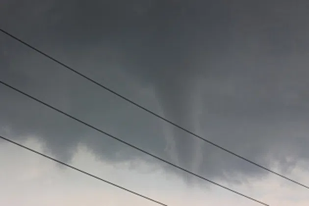
PEORIA, Ill. (WMBD) – The National Weather Service in Lincoln has confirmed that more than 170 tornadoes have occurred in Illinois in 2026.
As of June 25, the NWS has confirmed that 172 tornadoes have touched down in Illinois this year. The number was revised down from 173 after high-resolution satellite imagery showed that the damage paths of two tornadoes that occurred near Effingham on June 17 were actually connected.
On average, the state of Illinois experiences 63 tornadoes a year, with most of those tornadoes coming in April, May, and June. This year, April and June have been our most active months by a long shot with more than 60 tornadoes reported in each month.
The 172 tornadoes that Illinois has experienced are the most in the country, and more than double that of the state of Mississippi, which has had 84 tornadoes according to the Storm Prediction Center (SPC).
2026 Top States for Tornadoes
| State | Number of Tornadoes |
|---|---|
| 1. Illinois | 172* |
| 2. Mississippi | 84 |
| 3. Missouri | 78 |
| 4. Indiana | 73* |
| 5. Iowa | 64 |
| Source: SPC | * Confirmed tornado reports via NWS |
According to NOAA’s National Severe Weather Archive, Illinois has experienced well over 100 tornadoes each year since 2023, significantly more than the average of 63. The previous record year was 2024 with 142 tornadoes, but more than 40 of those tornadoes actually came in a single event, the July 15 Derecho.
Illinois Tornadoes Since 2017
| Year | Number of Illinois Tornadoes |
|---|---|
| 2017 | 50 |
| 2018 | 55 |
| 2019 | 49 |
| 2020 | 63 |
| 2021 | 74 |
| 2022 | 35 |
| 2023 | 120 |
| 2024 | 142 |
| 2025 | 126 |
| 2026 | 172 |
So why are we seeing more tornadoes now?
Without a doubt, better technology, more awareness, and a better understanding of tornadoes are a big reason why we’re counting more tornadoes now than ever before. The implementation of dual-pol radar now makes tornadoes easier to confirm via radar, giving meteorologists a better understanding of what is rain and hail versus debris. The fact that everyone has a camera in their pocket and storm chasers with live streams makes it easier for reports to be confirmed in near real-time.
In the past, damage associated with a destructive bow echo surging through Illinois largely would have been reported as wind damage. Now, with dual-pol radar and hi-res satellite imagery, NWS meteorologists can better identify tornadoes that formed within a broader area of wind damage. This was the case with the April 17th tornado outbreak in which several tornadoes were identified days after the event.
The weather pattern has also played a role by bringing a more favorable storm environment to Illinois. Studies have shown that transitions from La Niña winters to neutral or El Niño patterns tend to bring more severe weather outbreaks to the Midwest and the Southeast. That certainly appears to be the case this year as we started the year in a weak La Niña and are now in an El Niño, one that could prove to be one of the strongest on record.
When we look at the approximate pattern since March, we see the strong jet stream overhead combined with ridging over the southeast U.S. and a trough over the Central Plains. This is a type of pattern that brings frequent storm systems and a steady flow of moisture from the Gulf into the Midwest. If those systems are well timed, as they have been this year, repeated rounds of severe weather can happen.
Is tornado alley shifting?
The answer to this question depends on where you consider Tornado Alley to be. Many consider Tornado Alley to be across Texas, Oklahoma, Kansas, & Nebraska but tornadoes have always been relatively common between the Rocky and Appalachian Mountain ranges. In fact, that part of the U.S. experiences more tornadoes than any other part of the world.
That said, a study done back in 2018 found that there are more favorable tornado days per decade across the Midwest and the southeast, while parts of Texas, Oklahoma, and Kansas have seen a bit of a reduction in favorable tornado days.

While there certainly appears to be a trend for more tornadoes across the Midwest, including Illinois, the discussions of that trend seem to be a little exaggerated as the study shows that we’re seeing only 1-3 days more of favorable tornado days each decade.
I sat down with Meteorologist Mike Albano from the National Weather Service Office in Lincoln to discuss more on these tornado trends. You can see this conversation in full on this week’s episode of Shootin’ the Breeze which is now streaming on WMBD+ and CIProud.com.