By WMBD-TV
CENTRAL ILLINOIS – October has been off to a warm start but that may not stop our first frost from reaching Central Illinois early next week.
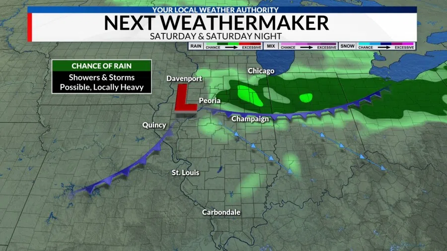
A cold front will work it’s way through the region from Friday night through Saturday night. As the front pushes through, a few showers and storms will be possible, particularly on Saturday and Saturday night.
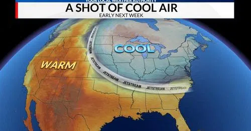
By Sunday, the rain should be gone but gusty northwesterly winds will help usher in cooler temperatures that will settle over the area early next week.
Monday & Tuesday
Highs on Monday and Tuesday are likely to remain in the upper 50s while night time low dip into the mid 30s. If skies remain clear and wind speeds remain light, widespread frost will be possible Tuesday morning with patchy frost possible Wednesday morning.
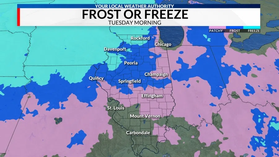
Some areas west of the Illinois River may see their temperatures drop below freezing Tuesday morning, but a widespread freeze is not expected. The average date for our first freeze occurs around the middle of October for most of the area. You can read up on our first freeze stats here.
WMBD-TV can be reached at news@wjbc.com.