
By Illinois Radio Network
There’s a trail of downed trees and missing shingles from Rockford to I-80 and from the Quad Cities to the Chicago suburbs.
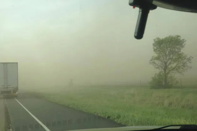
The National Weather Service is sifting through the damage reports from Wednesday night’s severe storms. Central Illinois was hit by high winds that kicked up blinding dust and caused several accidents near Bloomington, Downs and Springfield due to reduced visibility.
Weather Service meteorologist Tom Philip said Illinois saw a lot of wind, some golf ball-sized hail, and what may be a weak tornado in Henry and Mercer counties.
“There’s a storm that tracked from southeast of Aledo towards northeast of Geneseo,” Philip said. “That’s one of the areas we’ll be looking at to investigate if there was a tornado touchdown or not.”
Phillip said there’s also a team from the weather service in Iowa looking at storm damage there.
Iowa and Wisconsin saw more storm damage reports from the same system. Philip says Illinois dodged the bullet a little bit.
“We did have quite a bit of hail and high wind reports across mainly areas along and north of Interstate 80,” Philip said.
The chance for severe weather is moving downstate, but forecasters say there’s only a “marginal” risk for more severe storms on Thursday for residents between I-80 and I-64.